Geopark Boundary
LOCATION OF THE AREA
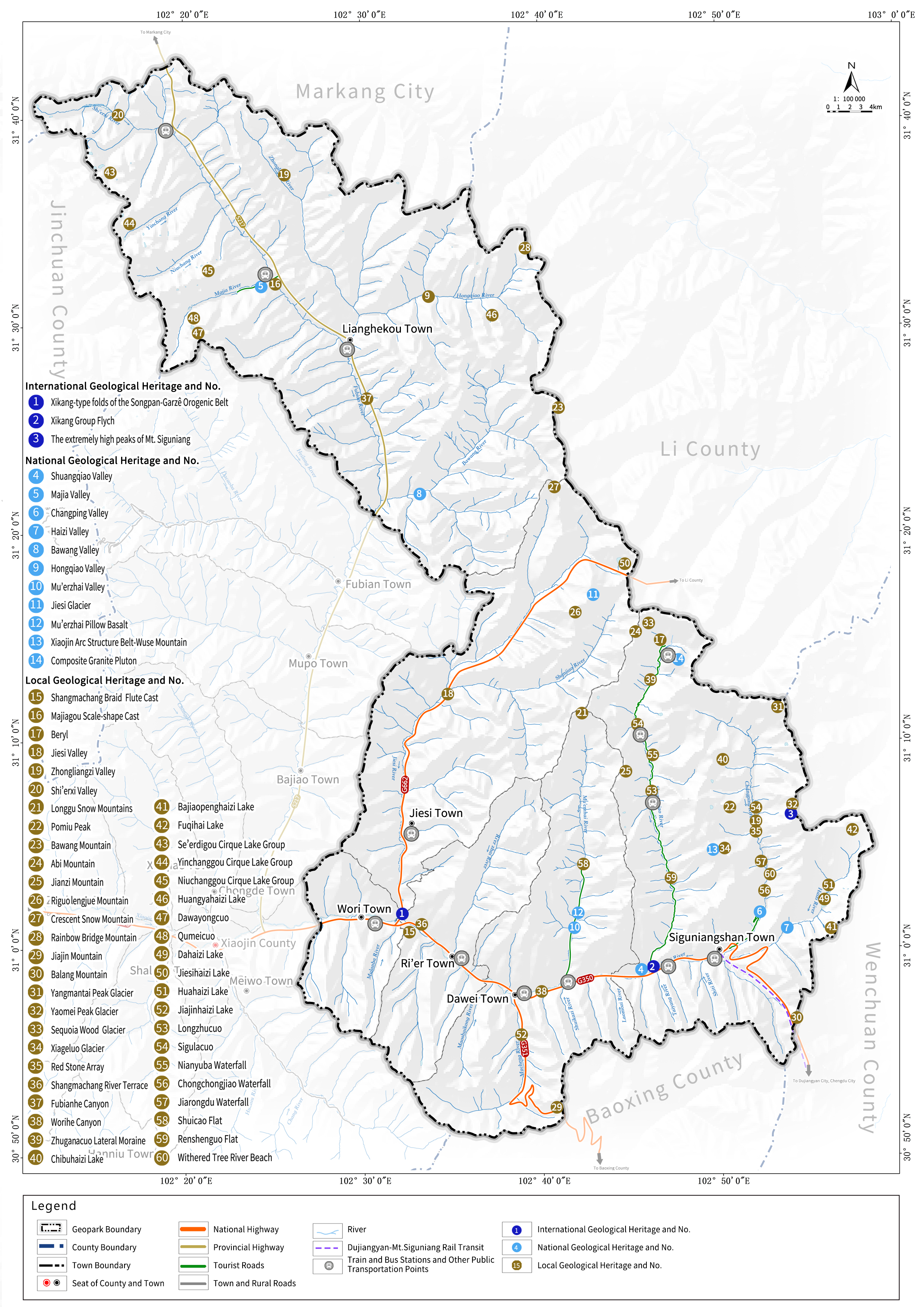
Mt. Siguniang Geopark is located in Xiaojin County, southern Aba Tibetan and Qiang Autonomous Prefecture, Sichuan Province, the People′s Republic of China. The geopark lies at the junction of the eastern section of the Songpan-Garzê Block and the Longmenshan Fault Zone. It is bounded by the Xianshuihe Fault Zone to the east of the Songpan-Garzê Plateau, the Longmenshan Fault Zone to the west, and the East Kunlun Fault Zone to the south, forming an inverted triangular region.
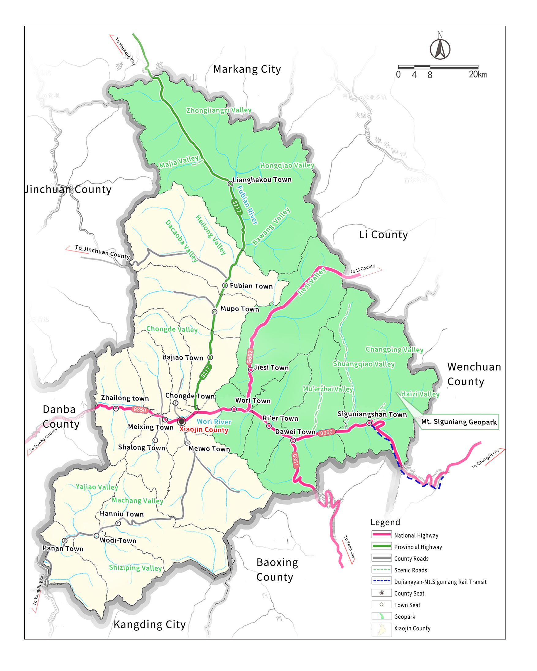
The geopark comprises six towns: Siguniangshan, Dawei, Jiesi, Ri′er, Wori, and Lianghekou. It spans geographical coordinates N30°50′47.30″ to N31°42′57.17″ to E102°11′38.25″ to E102°58′38.85″, with boundaries defined by county and town borders.
©
2025
Mt. Siguniang National Nature Reserve Administration (Mt. Siguniang National Geopark Administration) 蜀ICP备15012956号-5 | Support【yihtc.com】Address:50 meters northwest of No. 56, Siguniang Mountain Town, Xiaojin County, Aba Prefecture, Sichuan Province, China Hotline:400-688-6250 Complaints Hotline:0837-2791158 Fax:00-86-0837-2791257 Rescue Phone:0837-2791110 E-mail Address:sgnsyxc@163.com