Overview of Geopark
Mt. Siguniang Geopark is located in Xiaojin County, Aba Tibetan and Qiang Autono-mous Prefecture,Sichuan Province, People’ s Republic of China, at the transitional zone between Qinghai-Tibetan Plateau and Sichuan Basin,with geographic coordi-nates:N30°50′39.450″~31°42′58.171″ E102°11′32.163″~102°59′2.497″. Geopark spans a total area of 2,764.01 km² and features main geological heritages such as the “Xikang-type” folds of the Songpan-Garzê Orogenic Belt, “Xikang-Group” Turbidite Flysch Formation, the high mountain peaks of the eastern Qinghai-Tibetan Plateau, and Quaterna-ry glacial remnants. It also encompasses typical geological phenomena including submarine volcanic eruptions, deep-sea to semi-deep-sea sedimentary structures, regional tectonic events, magmatic intrusions, and glacial climatic events. These elements collectively record the geological evolution from the Paleo-Tethys Ocean margin basin to the uplift of the eastern Qinghai-Tibetan Plateau, offering significant scientific value and global comparative importance.

Distinctive Feature and Value of the Geopark
World's Largest Triassic Flysch Sedimentary Zone Mt. Siguniang Geopark is located within the Songpan-Garzê Orogenic Belt, which hosts the world's largest Triassic flysch sedimentary zone. Geopark’s Xikang-Group” Turbidite Flysch Formation provide a reliable record of Middle to Late Triassic sedimentation. Within these flysch strata exhibit well-preserved Baoma sequences and abundant sedimentary structures such as imprints and ripple marks. They serve as key evidence for recon-structing the lithofacies and paleogeography of the Triassic in the Songpan-Garzê Basin, the subduction and closure history of the Paleo-Tethys Ocean, and the orogenic process of the Songpan-Garzê Orogenic Belt, offering significant global scientific importance.
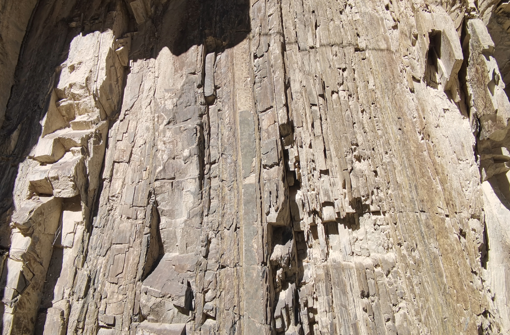
Flysch Deposits
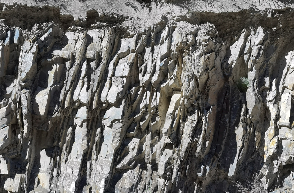
Flysch Deposits
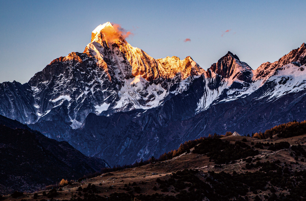
The Extremely High Peaks of Mt. Siguniang
Geopark is located in a critical area where the Qinghai-Tibetan Plateau sharply descends toward Sichuan Basin. Its ancient orogenic foundation, complex uplift mecha-nisms, significant relative altitude difference, and magnificent snow-capped peaks make the Mt. Siguniang extremely high mountain range a quintessential representation of the high mountains on the eastern edge of the Qinghai-Tibetan Plateau.
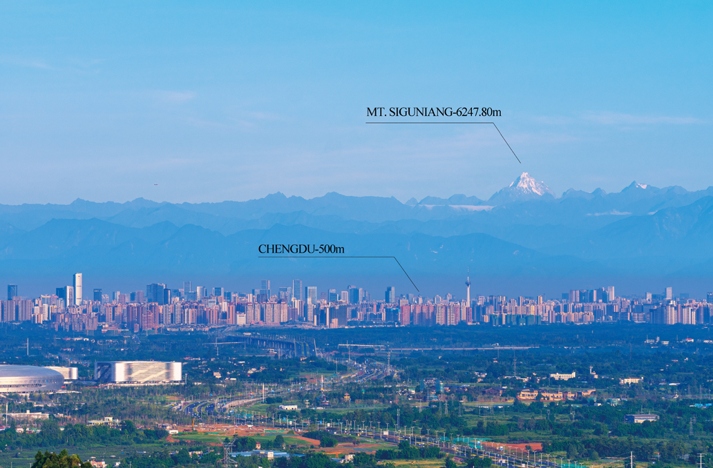
Yaomei Peak of Mt. Sigunaing Viewed from Chengdu

Yaomei Peak of Mt. Sigunaing Viewed from Chengdu
A Prominent Example of a Global Wedge-Shaped Orogenic Belt
Songpan-Garzê Orogenic Belt, located within the Geopark, lies between the North China Plate, the Qaidam Block, and the Qiangtang Block, and is bordered to the east by the Yangtze Plate (Sichuan Basin). This orogenic belt is characterized by a unique dual-polarity orogeny and structural system, differing from typical linear orogenic belts. It is a key region for understanding the tectonic evolution of the Qinghai-Tibet Plateau and represents a novel type of orogenic belt.
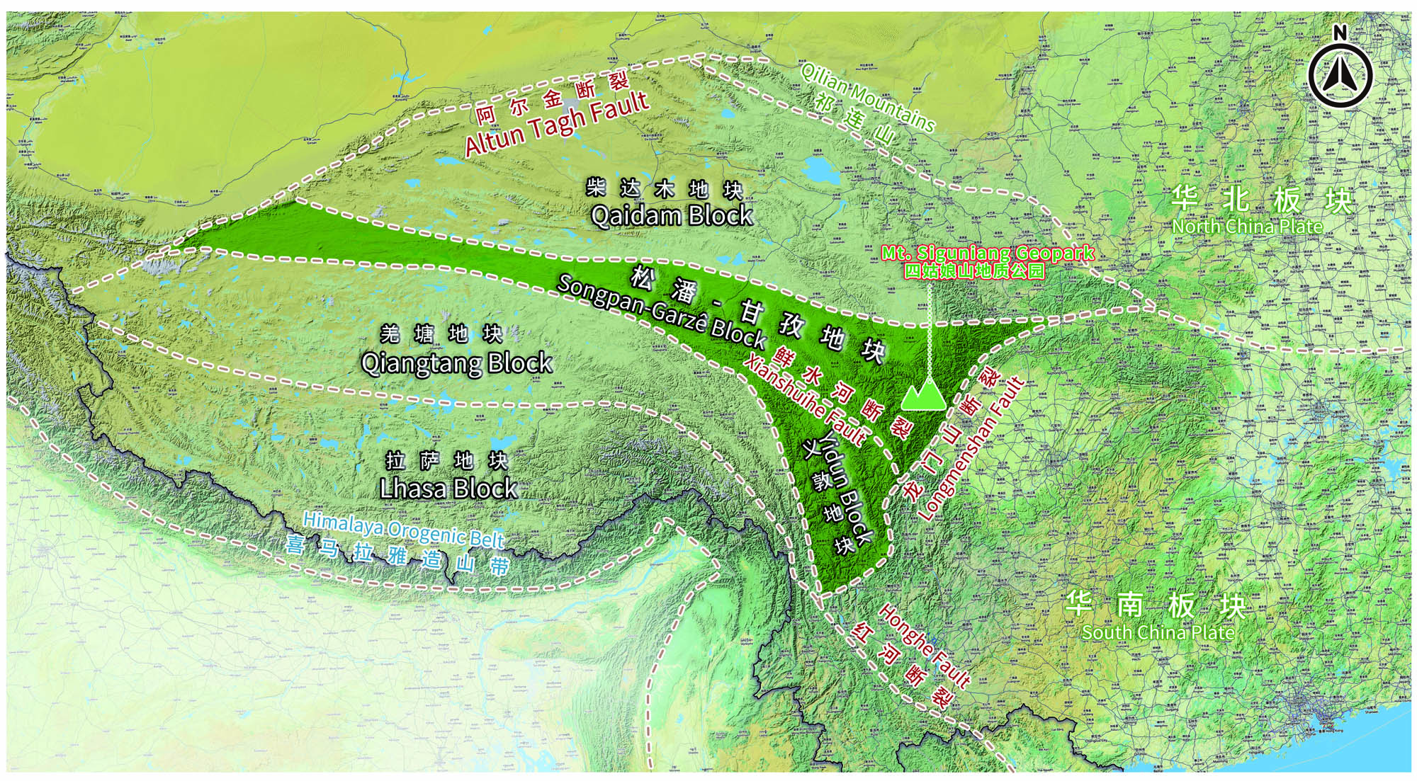
Location Map of the Songpan-Garzê Orogenic Belt
Quaternary Glaciation and Global Climate Change Sensitivity
Geopark is situated at the easternmost edge of modern glacier distribution in China and is a sensitive area for global climate change. During the Quaternary glacial period, intense glacial activity shaped the Mt. Siguniang area, leading to the development of mountain glaciers. Remnants of ancient glaciers, such as horn peaks, arêtes, glacial U-shaped valleys, glacial erosion lakes, glacial erratics, and moraines, are scattered throughout the landscape. These features provide valuable insights into the formation of the Mt. Siguni-ang glacial landforms and the climatic evolution during the Quaternary glaciations.
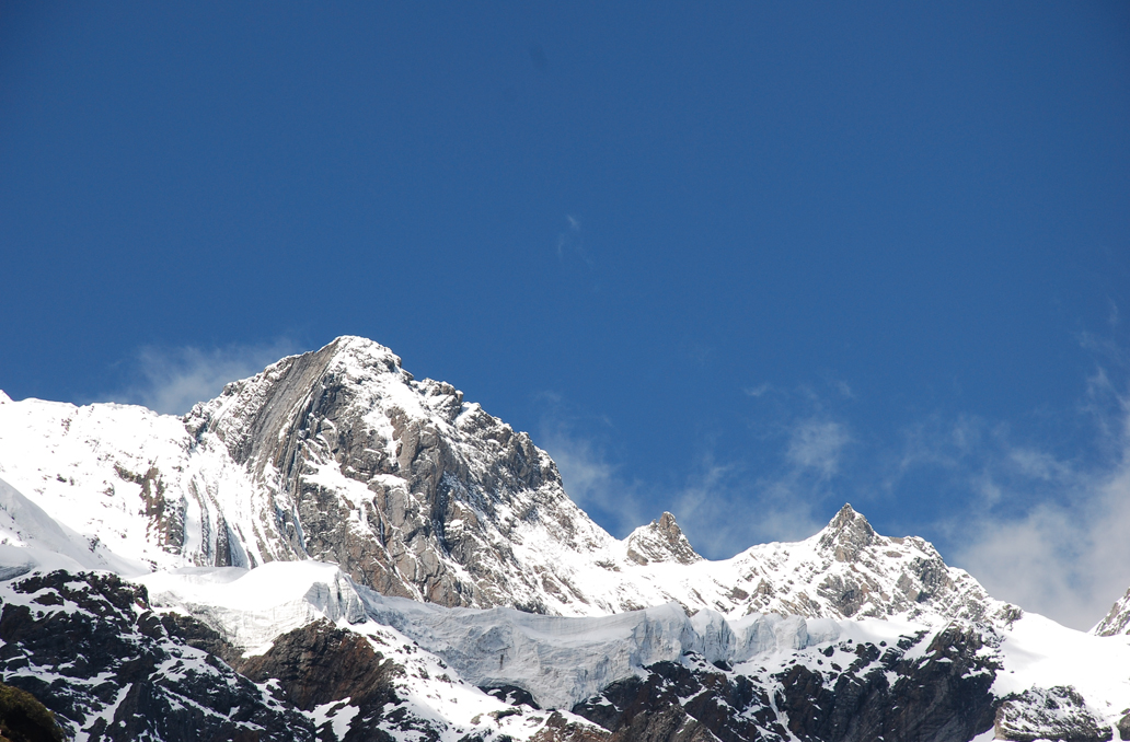
Jiesi Glacier
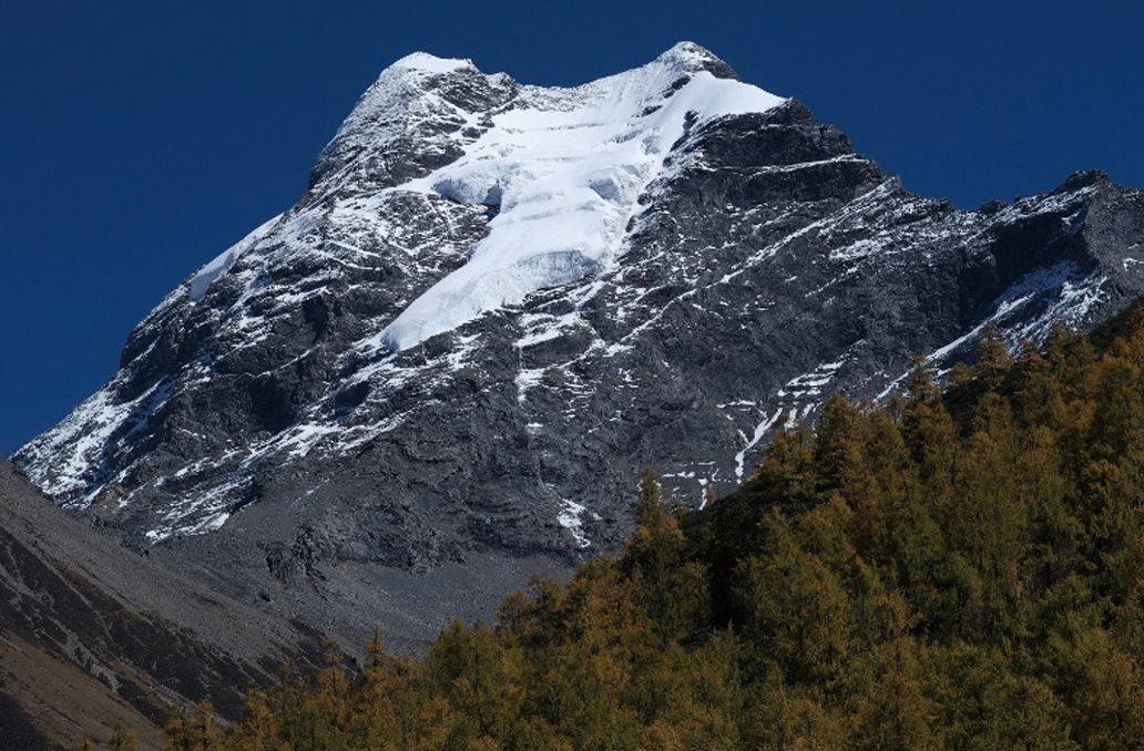
Xiageluo Glacier
Key Zone of China's Alpine Ecosystem
Geopark is a crucial part of China’ s alpine ecosystem. It’ s situated within one of the world’ s 36 biodiversity hotspots and spans multiple ecological gradients, nurturing 2,343 species of vascular plants and 343 species of wild animals. Geopark is home to the world's largest and oldest natural Chinese sea buckthorn (rhamnoides subsp. sinen-sis Rousi) forest, the endemic and endangered plants like Sichuan peony (Paeonia decomposita Hand.-Mazz ), as well as rare and protected animals such as the giant panda (Ailuropoda melanoleuca ), snow leopard,(Uncia uncia),golden snub-nosed monkey ( Rhinopithecus roxellane) , and Sichuan takin (Budorcas taxicolor tibetana) . As such, this region is a key zone for alpine ecosystem in China.

Red Panda
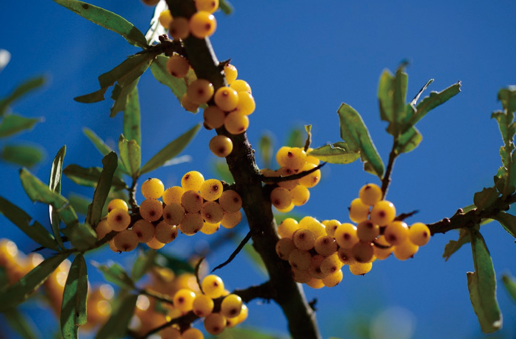
Chinese Sea Buckthorn
Cradle of Multi-Ethnic Tibetan Culture
Geopark is located at the intersection of Tibetan and Han cultural zones, where diverse ethnic histories and cultures blend and are passed down through generations. As the primary settlement area for the Jiarong Tibetan people, the geopark preserves the rich Jiarong Tibetan customs, including the vibrant traditions of the Mountain Worship Festi-val, Guozhuang Dance, and Tibetan Singing Festival, all of which display distinctive regional characteristics.
Indigenous people who inhabit this land, with deep reverence, preserve their ancient culture while also creating wealth with their diligent hands. Golden sea buckthorn, bloom-ing roses, and sweet apples stand as nature’ s generous gifts, symbolizing the harmonious coexistence between humans and nature, and embodying a hopeful vision for the future.
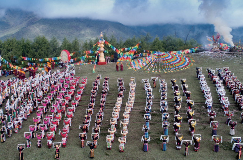
Mountain Worship Festival
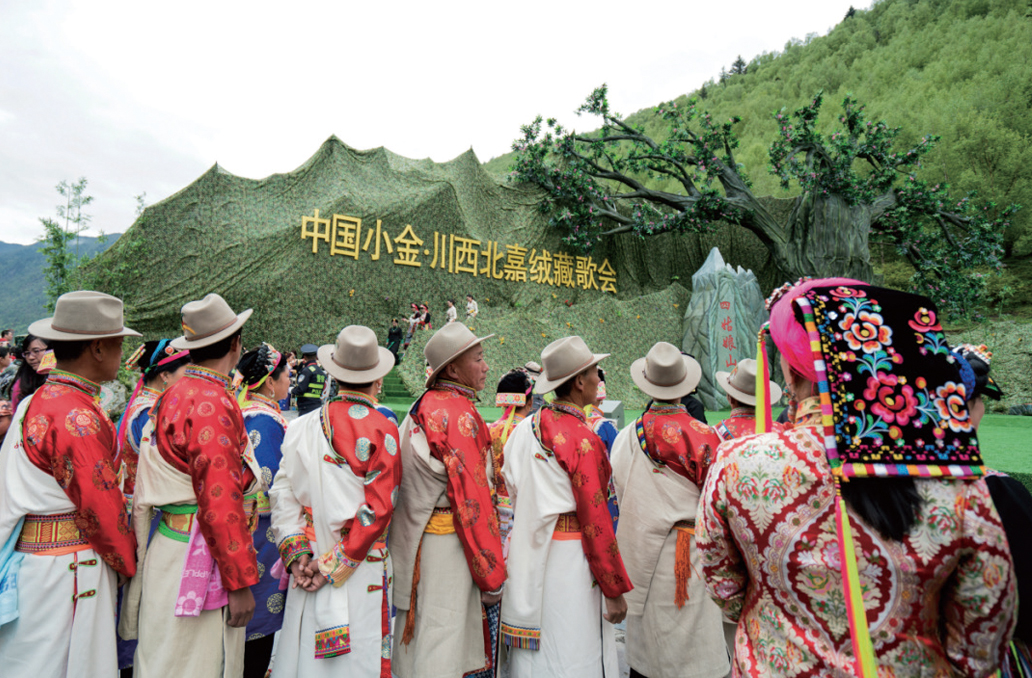
iarong Tibetan Song Festival of Northwest Sichuan
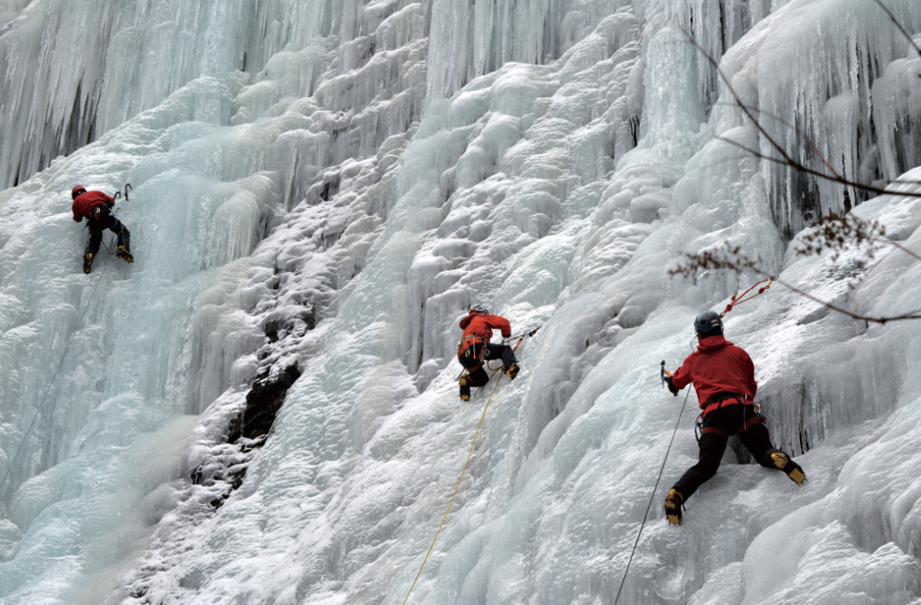
Eastern Sacred Mountain and Outdoor Paradise
As both an "Eastern Sacred Mountain" and "Outdoor Paradise," the geopark boasts international mountain resources. The towering peaks, with their varying heights and slopes, cater to climbers of all levels. In recent years, the geopark has capitalized on these natural advantages by hosting international events such as Ultra Tour Mt. Siguni-ang, mountaineering festivals, ice climbing festivals, and cycling races, drawing partici-pants from around the globe.
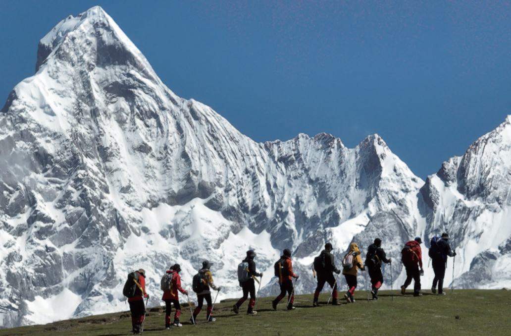
Hiking